If you’ve watched our weathercasts over the past several days, you’ve probably heard 1994 mentioned a time or two. Monday featured some of the coldest daytime readings South-Central KY has experienced since then. It’s been frigid, no doubt, but readings from the past two days don’t even hold a candle to the kind of temperatures and wind chills this state dealt with 20 years ago! Not to mention, the kind of snow and ice that preceded that cold. And that event was followed by another crippling ice storm just a few weeks later in February. Some of you may have better recollections of the second one, and for good reason. Back to that in a moment.
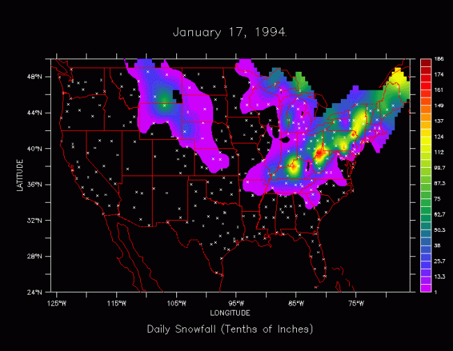
The night of January 16, 1994 was one of those times when all the right ingredients for a major winter storm came together for the lower Ohio Valley. Arctic cold was already in place. Bowling Green woke up to a reading of -1, which is the last time we had subzero with no snow on the ground. The temperature climbed into the upper 20s late that afternoon and evening as clouds rapidly increased. Winter Storm Warnings had been hoisted for the entire region. By nightfall, a messy mix of freezing rain and sleet had developed across Western KY, spreading eastward as the evening wore on. With the ground already very cold, roads quickly became icy and treacherous. To the north along the Ohio River, the mix changed to a very heavy snow in Paducah, Owensboro, and Louisville. “Thunder” snow was reported in some spots, with snowfall rates near 3″ per hour at the height of the event!
The change from a mix to snow worked southeastward through the night, reaching Bowling Green before daybreak on January 17th. While the city didn’t get in on the really huge snow totals seen over the northern half of the state, about a half a foot of snow fell on top of a 1/2-1″ of ice in the city before the snow moved out early that afternoon. The heavy snow/ice accumulations weighed down trees and power lines, causing electricity to go out for thousands. As temperatures tumbled from an early morning high in the lower 30s down into the teens by evening, all travel came to a halt! In fact, then Governor Bererton Jones declared a State of Emergency for the entire Commonwealth. All interstates and parkways were shut down so they could be cleared. But clearing the ice and snow was easier said then done.
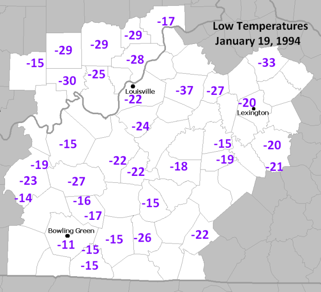
Things went from just plain cold on the 17th to INCREDIBLY cold on the 18th and 19th! The core of a frigid arctic air mass settled into the region on the 18th. Daytime temperatures hovered near 0 in Bowling Green, with wind chills near -20. As skies cleared and winds relaxed on the morning of the 19th, record low after record low went by the wayside. Most reporting stations across South-Central KY dropped into the teens below 0, some even into the -20s!
With readings so cold, salt was rendered useless on Kentucky roads for several days after the early week winter storm. This kept a lot of roads impassible, especially rural routes. Some places were only reachable by helicopter. And that wasn’t the only problem the cold caused. Natural gas explosions took out several homes near downtown Bowling Green during the height of this arctic outbreak. The extreme cold made putting out the large fires that ensued very difficult for firefighters.
By Thursday the 20th, a slow warmup and gradual improvements were underway. At least one lane of I-65 and the Natcher Parkway were opened, with both thoroughfares reopen by Friday as the State of Emergency was finally lifted.
Old Man Winter’s one-two punch had come and gone. The next few weeks saw generally milder weather for Kentucky. Then came the “TKO”: February 1994.
Few could have believed a paralyzing ice storm was just hours away from developing on Tuesday, Feb. 8th. The high that day reached a near record warm 72 degrees! A sharp cold front came through that night, bringing thunderstorms along with falling temperatures. By 6:00 the next morning, the mercury had fallen to 32, with rain changing to freezing rain then to snow as readings continued to fall into the 20s. Travel became hazardous on the afternoon and evening of the 9th.
Snow and ice stopped falling for awhile on the night of the 9th into the morning of the 10th…perhaps leading some to believe the worst was over. That was far from the case. A renewed round of moisture moved in from out of Arkansas and West Tennessee that afternoon. The air aloft had warmed while surface temperatures were still in the mid 20s. This was a recipe for trouble. Rain began falling in Bowling Green around mid-afternoon, freezing on contact. That rain continued all the way into the afternoon of the 11th before it finally tapered off to drizzle and ended that night. But the damage had been done.
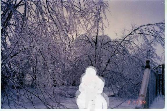
Bowling Green’s total for precipitation at the airport for the 10th & 11th: 1.61″, ALL of that coming as freezing rain!! Up to 2″ of ice was reported in nearby Barren and Allen Cos, with up to 3″ of ice to the east in London. Just as we’d seen a few weeks prior, most South-Central KY counties were back under States of Emergency. Power substations froze, and at one point nearly 200,000 people in the state had lost electricity. Utility lines and trees were draped across roadways with travel virtually impossible during and immediately after the event. For some homes and businesses, power was out as much as two weeks after the event. Below is a shot from Cave City taken 2/11/94:
That, my friends, was the TKO. January and February 1994 truly were a couple of ROUGH months for winter weather in South-Central KY…the kind we have not seen the likes of since!


